
Description
An IGN map to discover the Gulf of Morbihan
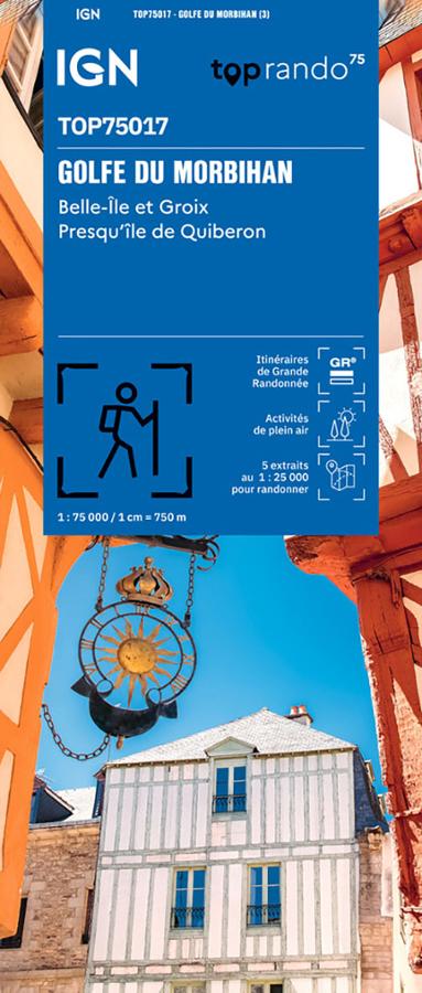
The IGN TOP75 Gulf of Morbihan map is ideal for planning a nature getaway in southern Brittany. It offers a comprehensive overview of the coastline, islands, peninsulas, coastal villages, and hiking trails.
It makes it easy to plan outings around the Gulf of Morbihan, the Quiberon peninsula, Belle-Île, and Groix Island. It's a practical tool for hikers, cyclists, and travelers who want to explore this part of Morbihan with a clear paper map.
Thanks to its 1:75,000 scale, the map provides a clear view of the area. It allows you to locate roads, access points, trails, ports, towns, and major tourist attractions.
Hiking, cycling, and discovering the Breton coastline
The Gulf of Morbihan is one of the most beautiful hiking areas in Brittany. Between coastal paths, rocky headlands, beaches, islands, harbors, and villages, there are countless opportunities for walks and hikes.
The map shows hiking trails, GR® (long-distance hiking trails), GR® de Pays (regional long-distance hiking trails), local roads, contour lines, and useful tourist information. It helps you plan a route, identify points of interest, and prepare day trips.
It is also suitable for cycling. The representation of the road network and cycle paths allows you to imagine routes between the coast, the Morbihan countryside, and access to the islands.
5 TOP25 zooms for greater precision
This TOP75 map includes five 1:25,000 scale extracts. These zooms provide a finer level of detail on certain exceptional natural areas.
They are particularly useful for planning a 1 or 2-day hike, especially in the most frequented coastal areas or those with the most trails. The map thus offers a good compromise between an overview and local precision.
Finally, it perfectly complements a guidebook or GPS track. It allows you to maintain an overview of the region, better plan your journeys, and prepare your stages before setting off.
Map Highlights:
- IGN TOP75 map dedicated to the Gulf of Morbihan
- Covers Belle-Île, Groix, and the Quiberon peninsula
- Main scale: 1:75,000
- 5 TOP25 extracts at 1:25,000
- Ideal for hiking, cycling, and outdoor activities
- GR®, GR® de Pays, and marked trails
- Local road network and cycle paths shown
- Useful tourist and cultural information
- Practical map for exploring southern Brittany
- Reliable paper map to complement a GPS
What area does the IGN TOP75 Gulf of Morbihan map cover?
It covers the Gulf of Morbihan, Belle-Île, Groix Island, the Quiberon Peninsula, and part of the southern Breton coastline.
Is this map suitable for hiking?
Yes. It shows trails, GR® long-distance footpaths, GR® de Pays long-distance footpaths, terrain features, and useful information for planning hikes.
Can it be used for cycling?
Yes. The map shows the road network, cycle paths, and connections between different areas of Morbihan.
What is the scale of this map?
The main scale is 1:75,000. It provides a good overview of the area.
Does the map include detailed zooms?
Yes. It includes five 1:25,000 scale sections, useful for planning more specific hikes in certain notable areas.
Features
Name
IGN TOP75 map Gulf of Morbihan – Belle-Île, Groix and Quiberon
Width
11.5 cm
Height
25 cm
Weight
0.1 kg
Language
French