Description
A practical map for discovering Ariège
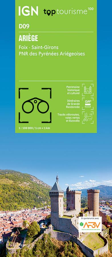
The IGN TOP100 Ariège map is an excellent tool for planning a trip between the Pyrenean foothills, wild valleys, charming villages, and major natural sites. It allows you to see the entire department at a glance.
With its 1:100,000 scale, it is particularly suitable for planning a trip, a road trip, a cycling tour, or a stay combining several activities. It offers a broader view than a 1:25,000 hiking map, making it very useful for planning your route and choosing which areas to explore.
It notably covers Foix, Saint-Girons, and the Ariège Pyrenees Regional Natural Park, a region prized for its mountains, valleys, forests, mountain passes, and heritage.
Hiking, Cycling, and Tourism in the Ariège Pyrenees
Ariège is an ideal destination for nature lovers. Between the Pyrenees, mountain villages, caves, castles, mountain passes, and unspoiled valleys, there are countless opportunities for exploration.
This map helps locate GR® trails, hiking routes, scenic routes, cycle paths, and key points of interest. It is therefore useful for planning a trip, preparing stages, or connecting several sites in a single day.
For cyclists, it allows you to visualize the main roads, smaller roads, and marked cycle routes. It can thus be used to plan a circuit through the valleys, villages, and mountain passes of Ariège.
An overview map to be completed as needed
The IGN TOP100 Ariège map is particularly well-suited for organizing your travels and understanding the geography of the department. It provides a clear view of distances, access points, road connections, and major natural areas.
For very precise hiking, especially in the mountains, it can be supplemented with a local IGN TOP25 map. However, for planning a trip, identifying major routes, and creating a cycling or sightseeing itinerary, it is a very practical tool.
Map Highlights:
- IGN TOP100 map dedicated to Ariège
- Includes Foix, Saint-Girons, and the Ariège Pyrenees Regional Natural Park
- Scale: 1:100,000
- Ideal for planning a trip, a cycling tour, or sightseeing
- GR® trails, cycling routes, roads, and tourist sites are marked
- Good overview of the department
- Useful for organizing travel between valleys, villages, and mountains
- Practical paper map to complement a GPS or a more detailed map
FAQ
What area does the IGN TOP100 Ariège map cover?
It covers the Ariège department, including areas such as Foix, Saint-Girons, and the Pyrenees Ariégeoises Regional Natural Park.
Is this map suitable for cycling?
Yes. It allows you to locate roads, cycling routes, and connections between the main areas of the department.
Can it be used for hiking?
Yes, to plan outings and identify major routes. However, for specific mountain hikes, a local IGN TOP25 map is more suitable.
What is the scale of this map?
The scale is 1:100,000. This means that 1 cm on the map represents 1 km on the ground.
Is this map useful for planning a trip to Ariège?
Yes. It is very practical for organizing a route, choosing your stops, and visualizing the distances between sites to discover.
Features
Name
IGN TOP100 map of Ariège – Foix, Saint-Girons and the Ariège Pyrenees
Width
11.5 cm
Height
25 cm
Weight
0.1 kg
Scale
1/100 000
This might interest you
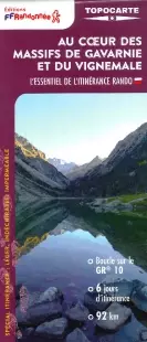
FFRP map - In the heart of the Gavarnie and Vignemale massifs
Take the GR10 for 62 km, in the heart of the Gavarnie and Vignemale massifs. Discover Cauteret, Lake Gaube, Hourquette d'Ossoue, and the Pyrenees landscapes. An invitation to beauty, listed as a UNESCO heritage site.
La traversée des Pyrénées - Pyrénées Ariégeoises et tours du Val du Garbet et du Baros - GR10 - GRPAYS
Topoguide FFRP sur la traversée de Pyrénées ariégeoises du Luchonnais au Lanoux sur le GR10 sur des sentiers balisés et sécurisés.