
Description
An IGN map for exploring Eastern Île-de-France
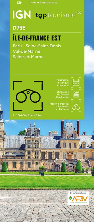
The IGN TOP100 Eastern Île-de-France map is ideal for planning a trip, an outdoor excursion, or a cycling tour around Paris and the eastern part of the region. It offers a clear overview of the area, encompassing cities, parks, forests, the banks of the Marne, villages, châteaux, leisure centers, and the wide-open spaces of Seine-et-Marne.
With its 1:100,000 scale, it allows you to visualize distances, access points, roads, and major routes. It helps you plan a day trip, a weekend getaway, or a longer excursion while maintaining a broad perspective of the region.
It covers Paris, Seine-Saint-Denis, Val-de-Marne, and Seine-et-Marne. It is therefore a highly practical map for planning travel between the urban core, the inner suburbs, and the expansive landscapes of eastern Île-de-France.
Hiking, cycling, and sightseeing around Paris
Eastern Île-de-France offers numerous opportunities for walking, cycling, and discovering the region's heritage. With the banks of the Marne, forests, canals, urban parks, Brie-region villages, historic towns, and major cycling routes, there is no shortage of ideas for outings.
For hikers, this map helps identify hiking trails and major walking areas. It assists in choosing a location, planning access, and organizing an itinerary. However, for precise on-the-ground navigation along a specific route, a local IGN TOP25 map remains more suitable.
For cyclists, it serves as an excellent planning tool. Cycle routes, greenways, and secondary roads allow you to devise loops, stages, or getaways connecting Paris, the banks of the Marne, canals, forests, and major sites in Seine-et-Marne.
A practical tool for planning outings in the region
The IGN "Top Tourisme" D75E Eastern Île-de-France map is particularly useful for maintaining a comprehensive view of the area. It makes it easy to connect various areas: Paris, Saint-Denis, Créteil, Vincennes, Meaux, Provins, Fontainebleau, the Marne and Seine valleys, and even vast forest areas.
It serves as an excellent complement to a guidebook, GPS track, or app. Its paper format allows you to compare routes, plan alternatives, and gain a better understanding of the region's layout.
Finally, this map is a simple, effective tool for planning outings around Paris. It is designed for hikers, cyclists, families, and travelers wishing to explore Eastern Île-de-France using a clear, reliable, and easy-to-use resource.
Map highlights:
- IGN TOP100 map covering Eastern Île-de-France
- 1:100,000 scale
- Reference D75E
- Covers Paris, Seine-Saint-Denis, Val-de-Marne, and Seine-et-Marne
- Tourist sites, hiking trails, and cycle routes all on one map
- Ideal for planning outings on foot, by bike, or by car
- Useful for organizing a weekend trip, a nature getaway, or a sightseeing tour
- Provides a great overview of the mix of cities, forests, valleys, canals, and villages
- Practical paper format to complement GPS or apps
- Suitable for families, hikers, cyclists, and travelers in the region
FAQ
What area does the IGN TOP100 Eastern Île-de-France map cover?
It covers the eastern part of the Île-de-France region, including Paris, Seine-Saint-Denis, Val-de-Marne, and Seine-et-Marne.
Is this map suitable for cycling?
Yes. It allows you to identify cycle routes, greenways, secondary roads, and local connections. It is therefore useful for planning cycling tours around Paris and in the eastern part of the region.
Can it be used for hiking?
Yes. It allows you to visualize hiking trails and major walking areas. To follow a specific route on the ground, a local IGN TOP25 map is still recommended.
What is the scale of this map?
The scale is 1:100,000. This means that 1 cm on the map corresponds to 1 km on the ground.
Why choose a TOP100 map for the eastern Île-de-France region?
Because it provides a very practical overview. It helps you plan outings, connect various sites, and map out routes between Paris, the banks of the Marne, the canals, forests, towns, and villages of the eastern Paris region.
Features
Name
IGN TOP100 Map Île-de-France East – Paris, Seine-Saint-Denis, Val-de-Marne, and Seine-et-Marne
Width
11.10 cm
Height
25.5 cm
Weight
0.1 kg
Language
French
Scale
1/100 000