Description
A map to rediscover France by train
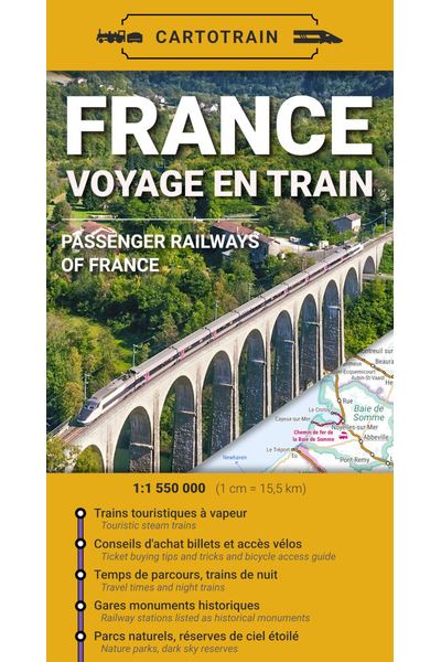
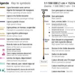
The *France – Voyage en train* (France – Train Travel) map by Cartotrain is designed for travelers who want to explore France in a different way. It allows you to visualize major railway lines as well as regional connections, key stations, and routes useful for planning a car-free trip.
With its comprehensive overview, this map helps you plan a trip that is slower, simpler, and more responsible. It is just as suitable for organizing a weekend getaway as it is for planning a full tour of France by train.
It is particularly useful for those who want to venture beyond the obvious routes. A paper map allows you to quickly spot alternatives, potential connections, or destinations that might not immediately come to mind when looking at a screen.
Traveling without a car: from major cities to local lines
This railway map of France is an excellent tool for planning trips between major cities, tourist resorts, natural regions, and lesser-known areas. It helps you understand how lines connect, where to change trains, and how to build a multi-stop itinerary.
It can be used to plan a city break, a touring holiday, a hike accessible by train, or a lower-carbon vacation. Moreover, it perfectly complements travel guides, the SNCF app, or online route planners.
It will also appeal to "slow travel" enthusiasts. The train becomes more than just a means of transport; it becomes part of the journey itself. You travel through landscapes, discover regions from a new perspective, and take the time to enjoy the journey to your destination.
A practical tool for planning your rail journeys
The *France – Voyage en train* map provides a comprehensive overview of the network. This is very handy before booking tickets, as it helps visualize distances, major routes, and connection options.
It can be used to plan a holiday itinerary, find a destination accessible without a car, or organize multiple stops along a single line. Finally, its paper format makes it a pleasure to consult, annotate, and use alongside digital tools. For cyclists and hikers, it also helps identify departure and arrival stations. It serves as an excellent starting point for planning a trip that combines train travel, walking, cycling, and local exploration.
Map highlights:
- Map dedicated to train travel in France
- Published by Cartotrain
- Ideal for planning a car-free trip
- Useful for organizing a weekend getaway, a short break, or a multi-stop journey
- Provides an overview of the French rail network
- Handy for spotting major routes and connections
- Great resource for "slow travel" and low-carbon journeys
- Useful complement to booking apps
- Suitable for travelers, hikers, cyclists, and rail tourism enthusiasts
- Inspiring paper map for planning future trips
FAQ
What is the "France – Train Travel" map used for?
It is used to plan train journeys and trips across France. It allows you to visualize rail connections and map out routes spanning multiple regions.
Is this map useful for car-free travel?
Yes. It helps identify destinations accessible by train and plan a car-free trip, whether for a weekend, a vacation, or a multi-stop journey.
Can it be used alongside a booking app?
Yes. The map provides an overview of the network, while an app allows you to check schedules, connections, and ticket availability.
Is this map suitable for hikers and cyclists?
Yes. It helps locate stations for reaching hiking trailheads, organizing a return journey by train, or planning a combined cycling and train trip.
Why choose a paper map for planning a train trip?
A paper map offers a better visualization of possible routes. It provides a comprehensive view, makes comparisons easier, and helps spark travel ideas that might not be as obvious on a screen.
Features
Name
Map of France – Train Travel – Cartotrain
Width
11 cm
Height
25 cm
Weight
0.1 kg
Language
French
pubication
2026