
Description
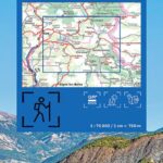
An IGN map for exploring the Ubaye Valley, the Val d’Allos, and Serre-Ponçon
The IGN TOP75 Ubaye Val d’Allos Serre-Ponçon Lake map is ideal for planning a hiking trip in the Southern Alps. It covers a diverse mountain landscape, including alpine valleys, high mountain passes, high-altitude villages, lakes, forests, and open panoramas.
It makes planning your outings around the Ubaye Valley, the Val d’Allos, and Serre-Ponçon Lake easy. It's a practical tool for hikers, cyclists, backpackers, and outdoor enthusiasts.
Thanks to its 1:75,000 scale, the map provides excellent visibility of the area. It helps you locate access points, roads, trails, valleys, and connections between different areas.
Hiking, cycling, and wide open spaces in the Southern Alps
The Ubaye Valley and the Val d’Allos are renowned hiking destinations. They offer mountain trails, GR® long-distance footpaths, mountain passes, mountain huts, viewpoints, and numerous natural sites.
The map shows contour lines, elevation points, rocky areas, local roads, GR® trails, and GR® de Pays trails. It therefore allows you to better anticipate the terrain and the difficulty of the routes.
It is also useful for cycling. The road network makes it easy to plan routes between valleys, mountain passes, and villages. The Serre-Ponçon area also offers excellent opportunities to combine cycling, hiking, and sightseeing.
5 TOP25 zooms for greater precision
This TOP75 map includes 5 extracts at a scale of 1:25,000. These zooms provide a finer level of detail on certain exceptional natural areas.
They are particularly useful for planning 1- or 2-day hikes. The map thus offers a good compromise between an overview and local precision.
Finally, it complements a GPS track or guidebook very well. It allows you to maintain a global view of the mountain range, plan your stages, and better understand the terrain before setting off.
Map Highlights:
- IGN TOP75 map dedicated to the Ubaye Valley, the Val d'Allos, and Lake Serre-Ponçon
- Main scale: 1:75,000
- 5 TOP25 extracts at 1:25,000
- Ideal for hiking, cycling, and outdoor activities
- GR®, GR® de Pays, and local roads shownRelief, contour lines, elevation points, and rocky areas
- Useful tourist and cultural information
- Practical map for planning a trip to the Southern Alps
- Reliable paper map to complement a GPS
FAQ
What area does the IGN TOP75 Ubaye Val d'Allos Serre-Ponçon map cover?
It covers the Ubaye Valley, the Val d'Allos, and Lake Serre-Ponçon in the Southern Alps.
Is this map suitable for hiking?
Yes. It shows the GR® (long-distance hiking trails), GR® de Pays (regional long-distance hiking trails), paths, terrain features, mountain huts, and other useful information for planning hikes.
Can this map be used for cycling?
Yes. It shows the road network, mountain passes, valleys, and access points. It is therefore useful for planning cycling routes.
What is the scale of this map?
The main scale is 1:75,000. It provides an overview of the area.
Does the map include detailed zooms?
Yes. It includes five 1:25,000 scale sections, which are useful for planning more specific hikes in certain areas.
Features
Name
IGN TOP75 map Ubaye – Val d’Allos – Lac de Serre-Ponçon
Width
11.5 cm
Height
25 cm
Weight
0.1 kg
Language
French
pubication
2024
Scale
1/75 000